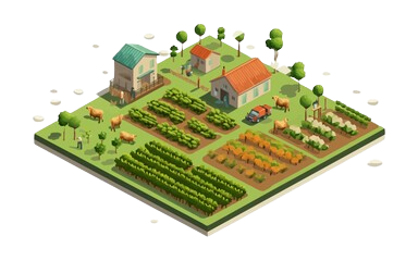
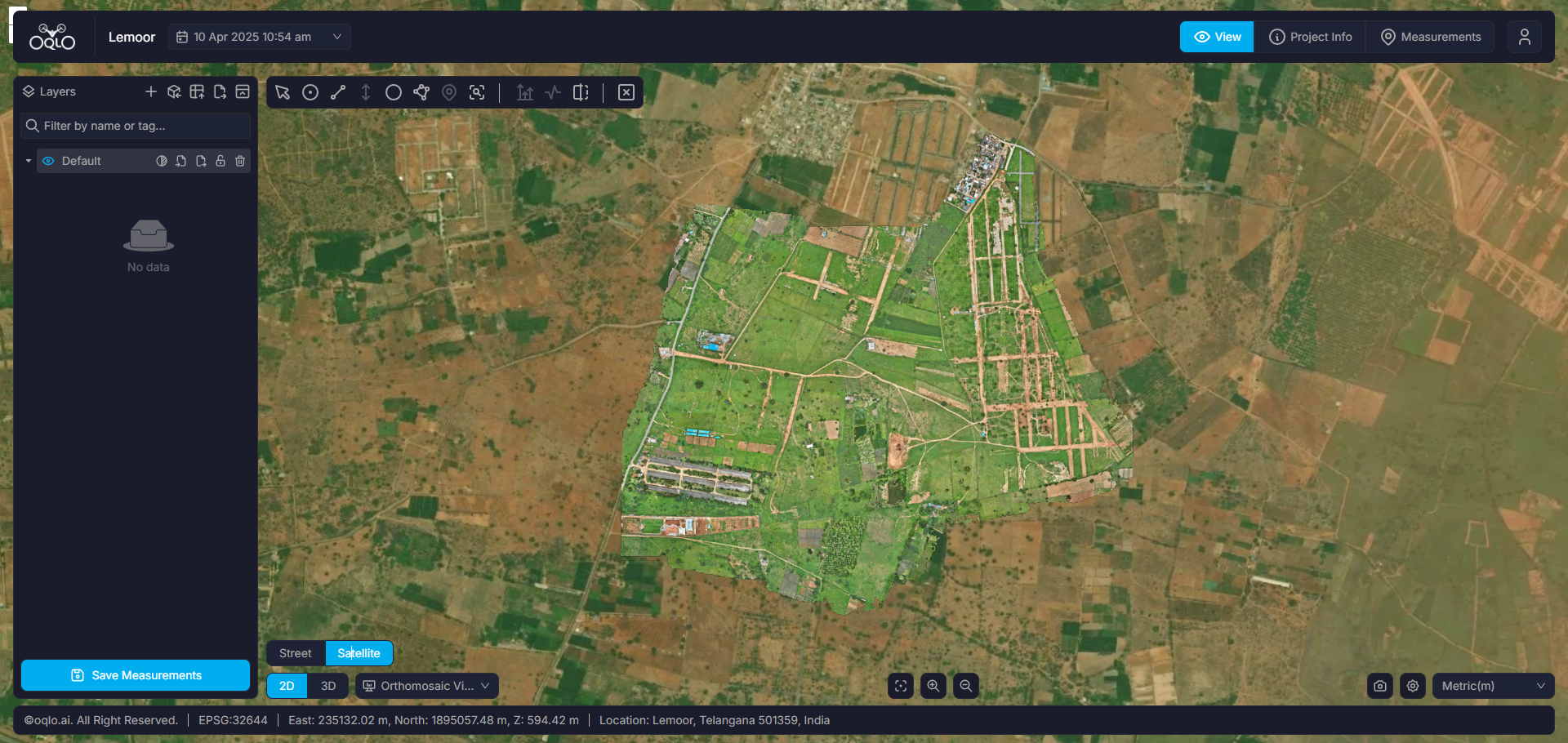
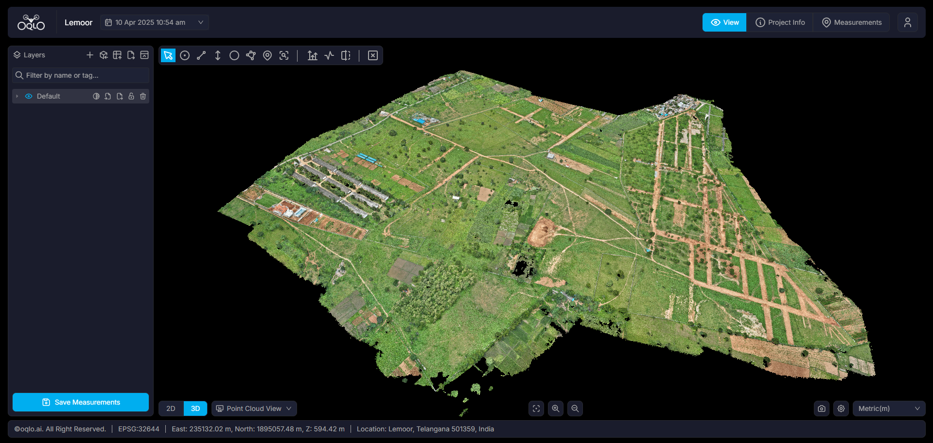
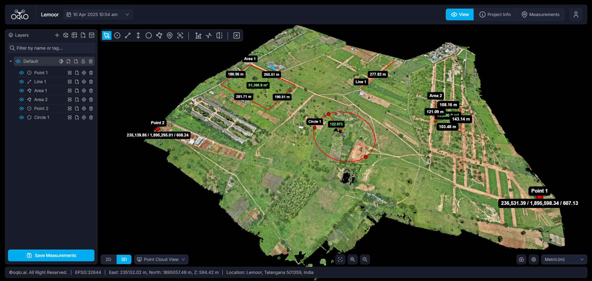
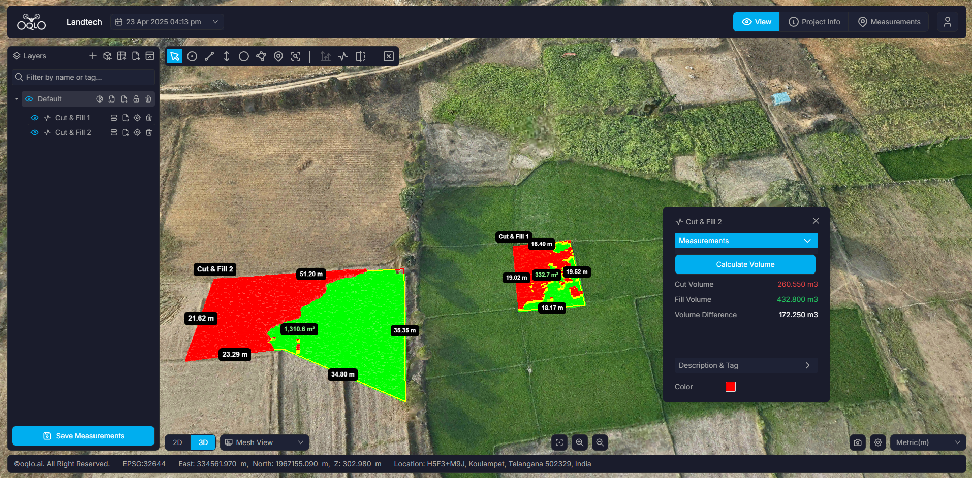
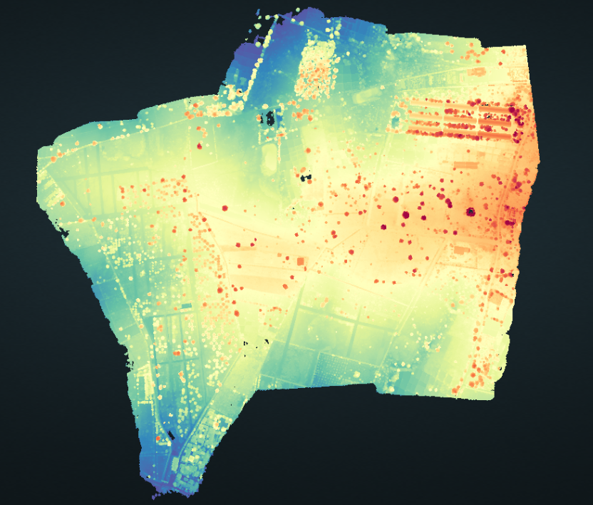
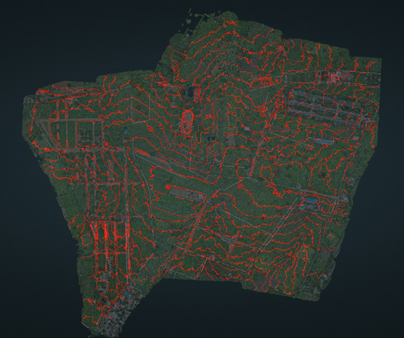
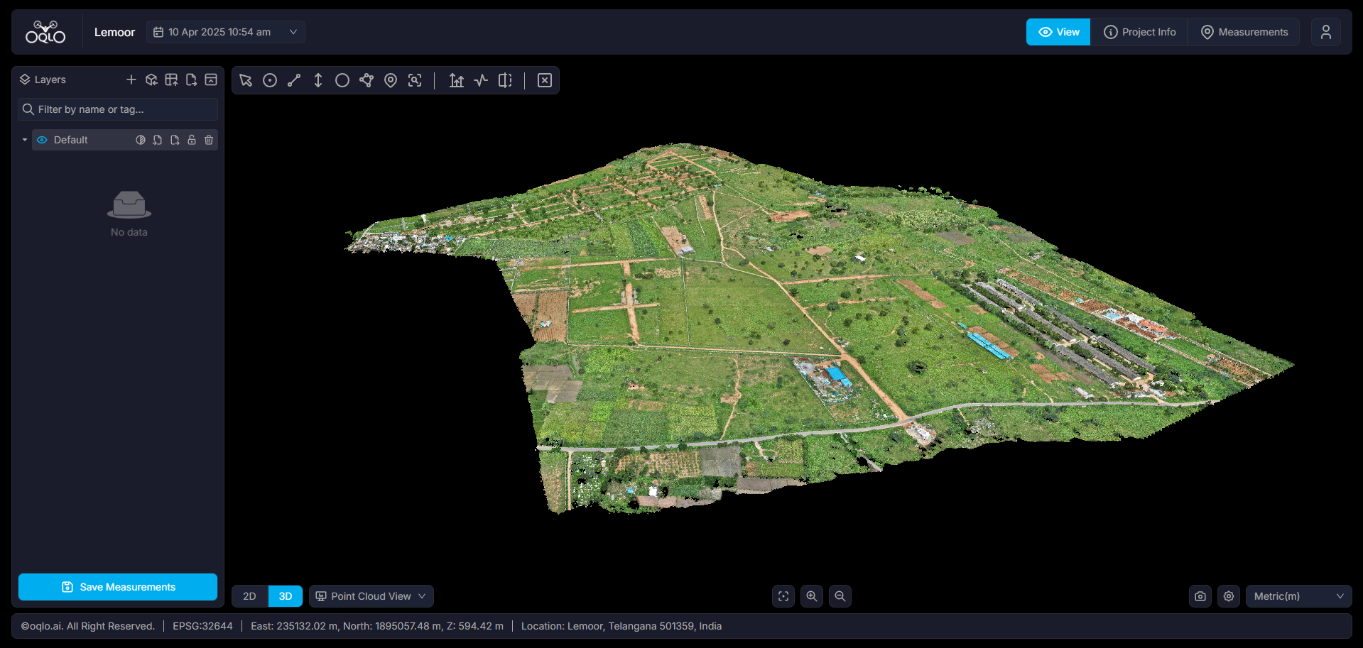
Drone Survey and Mapping in Agriculture

We provide real-time crop monitoring, accurate field analysis, and efficient farm management using AI and machine learning. Our drone solutions help detect issues early, ensuring healthier crops and higher yields

Drone scanning agriculture

Deliverables: What We Provide

1.Orthomosaic (2D)

1.Orthomosaic (2D)

2D orthomosaic maps capture detailed images of farmland, showing accurate locations and colors of crops. These maps help farmers measure distances, calculate field sizes, and monitor changes over time. They are useful for checking crop health, tracking growth, and making better farming decisions

2.Pointcloud (3D)

2.Pointcloud (3D)

A point cloud is a set of data points that show the exact positions (X, Y, Z) of crops, soil, and terrain in a field. It creates a detailed 3D view, allowing farmers to accurately measure distances, field elevations, and crop volumes when verified with control points

3.Measurement Tools

3.Measurement Tools

Measurement tools like point, distance, height, area, and annotations are essential in agriculture. They help with accurate planting, crop spacing, growth monitoring, field size calculation, and clear communication. These tools improve farming precision, efficiency, and productivity

4.Volumetric Analysis

4.Volumetric Analysis

Volume measurement tools in agriculture accurately measure crop yields, soil levels, and storage capacities for grains or silos. They help optimize resource use, improve planning, and reduce manual labor. Technologies like drones and 3D mapping make farm management more efficient, cost-effective, and precise

5.Digital Surface model

5.Digital Surface model

A Digital Surface Model (DSM) helps the agriculture sector by providing detailed elevation data of the land and crop surfaces. It supports precision farming, irrigation planning, soil erosion management, resource efficiency, and overall farm productivity.

6.Contour Lines

6.Contour Lines

Contour lines help in agriculture by indicating land slopes and elevations, aiding in soil conservation and water management. They guide contour plowing and terracing, reducing soil erosion, improving water retention, and enhancing crop yields on sloped terrains.

7.Mesh view

7.Mesh view

Mesh View helps in agriculture by creating precise 3D models of farmland for crop monitoring, soil analysis, and irrigation planning. It improves yield estimation, terrain assessment, and resource management, optimizing farming efficiency.

Benefits of Drone Technology in Agriculture

Real-Time Crop Monitoring

  • Captures high-resolution aerial images to monitor crop health and field conditions
  • Provides a detailed 3D view of farmland for better analysis and planning.
  • Enables frequent comparisons to track growth patterns and detect anomalies.

Precise Measurements for Better Yield

  • Ensures accurate elevation and soil grading for optimal irrigation and water pipeline
  • Provides precise distance, area, and volume measurements for efficient land use planning
  • Helps track crop yields, soil conditions, and resource distribution to maximize productivity

Improved Safety & Risk Prevention in Agriculture

  • Detects hazardous areas, such as flood-prone zones and unstable soil, to prevent crop damage
  • Minimizes the need for manual field inspections in dangerous or hard-to-reach areas
  • Ensures compliance with agricultural safety standards through accurate data monitoring

Optimized Cost & Time Efficiency in Agriculture

  • Accelerates field data collection compared to traditional surveying methods.
  • Reduces resource wastage through precise crop and soil analysis.
  • Prevents yield losses by detecting issues early and enabling timely interventions.